
Mile 3506: Boonville, NY
The next morning we were more than glad to leave our
corporate digs. We were leaving the
valley and going to enter the Adirondack Mountains. Wes was pretty excited about this portion of
the trip. He had been reading about peak color in the trees, and kept saying, “This
is the climax of the trip!” I was less
certain of that, but I had heard of these mountains and lakes all my life. I wanted to see what they were all about.
It was both ridiculous and appropriate that we missed our
exit coming out of the hotel and ended up on the freeway, instead of the road
to the mountains. We soon corrected our
error and found our way on the road to the foothills. I had picked out a path, using Google maps, that looked like the quickest and most direct
path into the mountains. We knew it was
going to be a day of climbing, so we just plugged along, ever climbing,
watching the houses become fewer and fewer.
We clear the first big set of foothills, then pass down into
valley. There we see a massive wooden
mansion with big white pillars and slate roof that must have been built in the 18th
century. It is empty now, but it has
been lived in within the last 10 years.
We wonder how such a spectacular house could be left to the elements.
There’s a hill after that, then another, then another. At one point, we can look back and see all
the way to the Catskills. Each hill is
followed by a valley. There is less and
less farming in each valley as each valley is higher than the next. The weather is chilly and there is a brisk
wind blowing from the west. We are not
too far from our junction with Egypt road, where we will turn to the east and
enter the Adirondack Park itself.
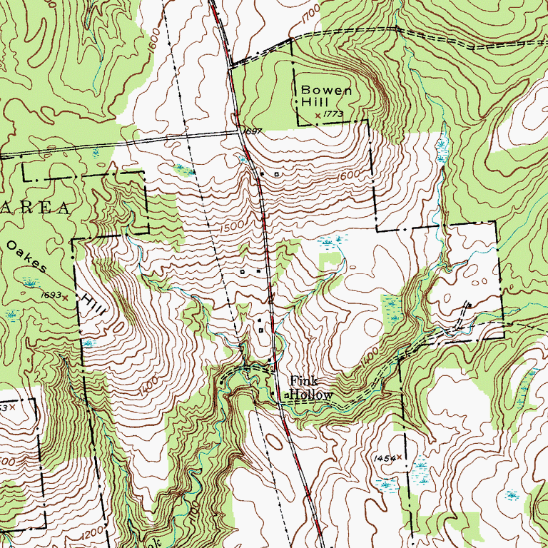 |
| Look how close the lines are! |
The hill is daunting, to say the least. We cycle as far as we can, then get off. This is a real doozy. Its grade is at least 8% with moments of
10%. We can’t comprehend how this road
would be passable in the winter. We walk
our bikes up it little bursts. First, in
chunks of 50 steps before stopping to breathe.
Soon it is 35 steps, then 25 steps at an effort. This hill is likely the single steepest hill
we have encountered on this trip. It is hard work and it takes us more than an
hour to clear its summit.
The clouds to the southwest are black. The wind is blowing briskly. We debate whether we can get to a town before
the rain starts to fall.
We have just cleared the hill, when a woman comes running
out of her house. She yells, “There’s a
tornado warning for all of Oneida County.
You need to seek shelter!” Wes
calls back to her, “Where should we go?” hoping that she will offer us refuge
at her house. She shouts back, “You need
to find a ditch or some other low place,” then runs back into the comfort of
her house.
We arrive at our junction when the sky turns pitch black and
the first fat rainfalls begin to pelt.
It is at least 10 miles to the next town down that junction. We have just entered the town of Boonville;
the village must be within 5 or so miles. However, the wind starts to roar, and we know
we better seek cover, NOW.
Just off the road, we can see an open barn. We start to make our way there when I notice
that farmhouse next to the barn is being renovated. No one is living there now, and the glass
covered porch is open and somewhat protected from the wind. We pull our bikes up on the porch. It is littered with milk crates, garbage
cans, and other construction detritus.
The wind is now howling and we are peering anxiously for the tell-tale
funnel clouds. They do not appear, but
the rain clouds do. It pours.
After 15 minutes, it appears that we might as well find a
way to sit down, so we arrange the milk crates and settle in for long
wait. After an hour of hard rain, we
make a “table” from a garbage can and a board, pull out the cook kit and Wesley’s
Roadside Cantina is in business. We warm
our fingers on the hot coffee, and eat all of the rest of last night’s
leftovers: a chopped salad and a vegetable calzone. We are dressed in gloves,
hats, fleeces, and rain gear. We have
arranged ourselves so that we are not getting hit by the wind, although this
took some doing as half of the windows are out.
We curl up next to each other as the rain pours on. The tarp which was covering the newly poured
basement of the farmhouse addition rattles and fills and empties over and
over. Wes is feeling sleepy, and I
tease him about his ability to sleep in any position at the drop of the
hat. I say, “You know me, I’m not the
napping type.” But there, snuggled up to
Wes, with the drone of rain and full belly, I fall fast asleep on Wes’
shoulder. I wake up an hour later and it is still raining. We have been on the porch for 3 hours. There are about 2 hours of sunlight left.
We wait and watch and wonder what to do. I use the program I just discovered to find
the route to the next town and identify lodging. We make a few calls and discover that the
only lodging still open at this late date is about six miles away, just outside
of Boonville. Well, we weren’t planning to
go to Boonville, but it is clearly the best option available. The rain has become a steady drum, which is
a big improvement from the downpour. As
much as we don’t relish getting wet or riding in the rain, we better get a move
on before it gets too late. 
It is close to 5pm when we leave our protected porch. It is raining for the first mile or so, but
as we clear the final hill before entering the Boonville valley, the rain
lifts, and a patch of blue sky appears.
We make our way to the town, which has a lot of 18th and 19th
century buildings, but feels very much like a frontier outpost. At the Colonial Motel, we are one of the few
guests, be we really like this “olde style” motel with its real wood furniture,
massive fireplace in the lobby, and great view of the Black River.
The host tells us we should eat at the 1890’s Boonville
Hotel, which stopped hosting overnight guests a generation ago, but has more
than a century of serving homegrown meals.
We eat in the nice but odd art deco style bar (which reminds us of Cliff Bell’s in Detroit) and order the special:
chicken and biscuits. We visit with the
folks there and we tell them of our hours on the porch just at the top of a
massive hill.
The young man, who sported a lumberjack/skateboarder look,
did a double take. “Wait. What hill did you come up?” We told him we came up Highway 74, and were
just going to turn onto Egypt Road before the big storm. He whistles, “You guys came up Potato Hill….that’s
unbelievable.” When the waitress came
over, he enthused, “These guys just road their bike up Potato Hill.” “Walked our bikes,” we corrected. “Still!
That is the single steepest way to get in this country. Wow, I am impressed.”
While he was impressed with our athletic achievement, I was abashed
at my horrible, but lucky, route selection.
Oh, well, we were safe; we were dry; we were about to eat one of the
best meals of the whole trip. Perhaps Potato
Hill was the right path after all.
No comments:
Post a Comment